Around 200 Potholes Filled on the Old Ridge Route by SoCalGas

SoCalGas has joined forces with the Ridge Route Preservation Organization to fill potholes on the 1915 Old Ridge Route. The 111 year old road runs between Castaic and Gorman and is the predecessor to the current day I-5 stretch, commonly refereed to as the Grapevine. This vital link, credited for uniting the state of California, sat largely unmaintained for decades. A group of dedicated volunteers has been working to save it.

Now, in April of 2026, SoCalGas is stepping up to help. Honoring a long time relationship between the pipelines and the road by filling potholes on nearly 12 miles of the Old Ridge Route.

In the process of pipeline maintenance and upgrades, SoCalGas has been using the Old Ridge Route as a vital access point. With it’s designation on the National Register of Historic Places, the road’s surface itself has special protections limiting weight, type or repairs and materials. The delivery of equipment and use of heavy machinery has created expected wear and tear. SoCalGas took initiative to repair the damage and go further – filling a substantial amount of potholes on the historic road. 

This is not the first time the company has stepped up to protect the Old Ridge Route. In early 2025, the SoCalGas Infrastructure Project Delivery team filled potholes on 6 miles of the road as they were working on access roads for pipeline maintenance. Though the history of SoCalGas and the Old Ridge Route date back even further. Their pipelines and the road have been intertwined since the beginning, constructing the first gas pipeline through the area in 1912, under the name Midway Gas Company. The pipeline was operational in 1913 – the same year the Old Ridge Route was surveyed.

This project was spearheaded by the SoCalGas team, Josh Torres (Project Manager), Ezequiel Avila (Construction Manager), Daniel Kimbro (Construction Manager), Alain Meyer (Construction Manager) Jose Giron, (Senior Supervisor, Pipeline) and Marisol Espinoza (Public Affairs Manager). The work was done by contractor, Henkels and McCoy, led by Edgar Razo (General Superintendent) – and we can’t forget the wonderful crew! Though I don’t have all of their names. If you would like to write a “Thank you” to the people involved, please use the form at the bottom of this post.

This project marks a major step forwards towards the goal of reopening the road. By filling potholes they are protecting the fragile edges of the road’s surface, creating a state of arrested decay. Keeping as much original road surface in tact as possible.

The next steps are to clean up the northern section, focusing our organization’s pothole project on the rougher open areas. Improving access for emergency services and visitors alike. There is still a landslide on the southern side of the road that will need repaired, as well as a failed drainage. We are looking for help with both so please reach out if you want to be a part of saving this old road!

We could not be more thankful to the people that made this happen! I cannot put into words how incredible this has all been and how wonderful the SoCalGas and Henkels and McCoy teams have been to work with.

If you would like to send a “thank you” note to the road crews, please use the form below – they deserve credit for all their hard work!

Written Comment on the Northlake Development Expansion

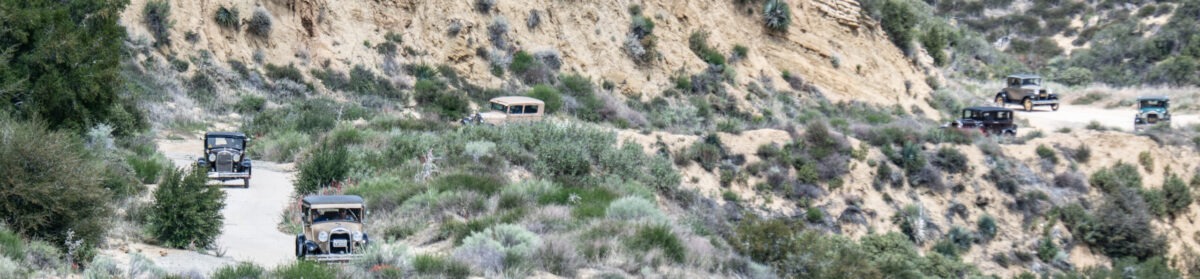
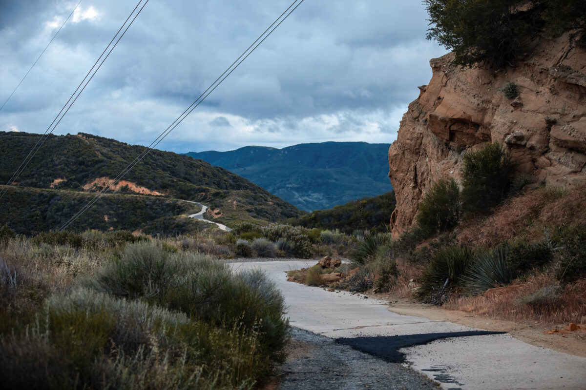
PHOTO: The Ridge Route, overlooking Queen Nell’s Castle and the homestead of Cornelia “Nellie” Martinez Callahan in Castaic, where the Northlake Development expansion is proposed.

In 1909, California was on the cutting edge of the Good Roads movement. $18 million of state bonds were passed to construct the revolutionary new highway system. Stagecoach roads would soon be a thing of the past and the automobile would take center stage. 

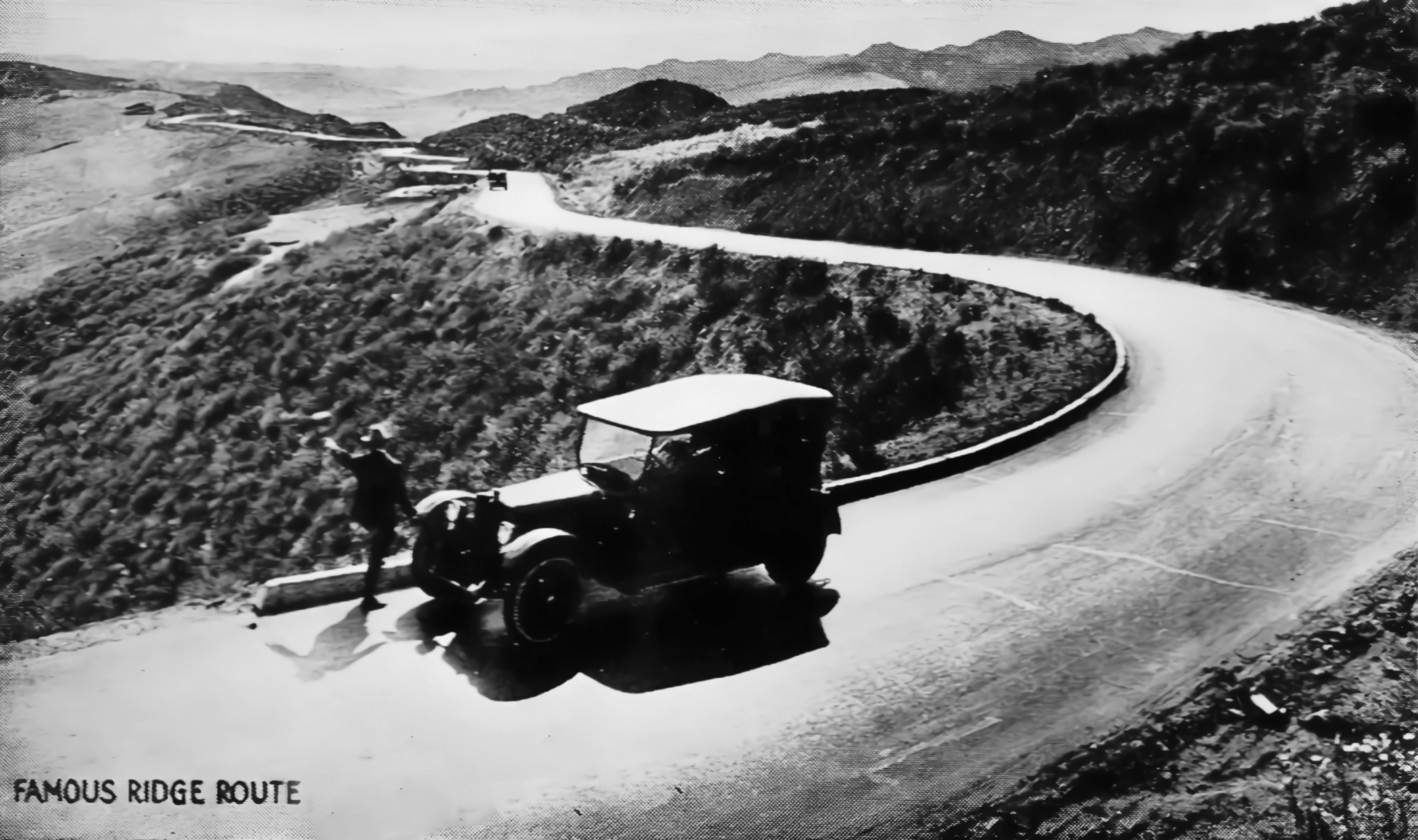
When they set out to build the Ridge Route, they were entering uncharted territory. Built by a railroad contractor who believed in the future of the automobile, paved later by WW1 veterans with experimental road surfaces and designed with the purpose of uniting a rapidly splitting California. This road changed the course of history and eventually, its successor, the I-5, would become one of the most important trade routes in the country. 

We say this to inform you that the Ridge Route isn’t just another winding road. It has been a core part of our community since its opening in 1915 and a key part of our local history. Something worth honoring and protecting. While we understand that progress is inevitable, our organization exists to preserve what we can and document and recover what we can’t. 

The proposed expansion of the Northlake Development will impact the Ridge Route, realigning 1.5 miles of the road and developing alongside nearly 4 miles of this historic corridor. Along the western border of the project site, hidden off to the edges of the road are C Blocks. Concrete markers placed by the California Highway Commission during the surveying and construction of the road (1913-1915) to mark the original right-of-way. The project site also covers the historic locations of “Queen Nell’s Castle” – the homestead of Cornelia “Nellie” Martinez Callahan, and the Owl Garage. Both locations are no longer standing but could have artifacts such as bottles, plates and old car parts. Our organization would like to work with your archaeologists to ensure these markers and artifacts are collected and protected. 

Of concern for the future, we worry about the impact of relying on one road to be the only exit for an entire community. The Ridge Route is no stranger to fires and the area was referred to as a “historic fire corridor” in the Northlake Environmental Impact Report. Fires reported at Templin Highway and the I-5 are ever prevalent. The project site burned in the 2022 Route Fire and was under evacuation as recently as the 2025 Hughes Fire. With the widening of the road to 4 lanes, there would now be two southbound lanes and one northbound lane available for evacuation and potentially only for 30 minutes in the case of the “Freeway Spot Scenario” (Northlake EIR). 

It is out of concern for the future residents that we suggest looking into creating a secondary southern exit route for the community. Not only for evacuations, but to alleviate traffic on Ridge Route Road, which often functions as a bypass for the I-5 when there is an accident north of Castaic. Allowing residents to come and go unaffected by the freeway conditions. 

The Ridge Route Preservation Organization hopes to work with your archaeologist to preserve and honor our local history and encourage your developer to take measures to ensure the safety of future residents. Thank you for your time and consideration.

—–

The hearing for the expansion of the Northlake development is tomorrow (1/28) at 9AM. If you would like to submit a written comment, make sure to submit it before noon today.

Here is where you can find information on address to join in person or zoom link to join online: https://lacdrp.legistar.com/MeetingDetail.aspx?ID=1356322&GUID=D5123612-4911-4904-8059-E23A32EE5DC7&Options=&Search=]

To submit a written comment:

To provide written public comment for the record, send an email to comment@planning.lacounty.gov with the agenda item number, first name, last name, email address, and phone number, and identify yourself as the applicant or not the applicant. Written public comments submitted prior to 12 p.m. on Tuesday, January 27, 2026, will be provided to the Regional Planning Commission. Written public comments submitted after 12 p.m. on Tuesday, January 27, 2026, will not be provided to the Regional Planning Commission but will be added to the public record.

New Video – Clean Up The Ridge Route Introduction

Greetings All!

We have recently produced a new video on our Clean Up The Ridge Route events which discusses what they are and how you can get involved. This last storm may have caused some damage to the road, and we can use your help up there to repair it.

November 2025 Storm Update

The storm that is currently hitting Southern California is predicted to drop quite a bit of precipitation on the Ridge Route area. We will be monitoring the weather and assessing whatever damage may occur as soon as we can after the storm has clear. We will need your help afterward to help clear the road and repair any damage. We also wish to thank all those that have helped us so far during our CUTRR events, which have reduced potential hazards along the road and ensured its continued existence.

Regardless of the position of the gates, no travel is recommended over the Ridge Route during or after this storm. There could be many hazards up there that could either leave you stuck or otherwise stranded on the road. Such travel can also damage the roadway, which is also something we want to avoid.

If you’d like to monitor the weather yourself, here are some sites you might want to consider:

Weather Forecasts from the National Weather Service:

Rainfall Totals for Gorman, Sandberg, Castaic Powerhouse, and Castaic from Los Angeles County Public Works

AlertCalifornia Cameras

New Video – Ridge Route Basics

The Historic Highway 99 Association of California, in conjunction with the RRPO, has produced a video on the basics of the Ridge Route and some of the features that make the road unique. Learn about the curbs, rails, footprints of all types, tire tracks, and more that can be found on the road. They also talk about the different pavement types on the road as well as how you can get up there and see the road yourself.

The Historic Highway 99 Association of California has also produced other videos talking about other sections of the highway, including the bridges over the Santa Clara River and Castaic Creek in their “History along US 99” series.