The Grapevine or The Ridge Route?
by Michael F Ballard
I-5 is commonly referred to as “The Grapevine” by locals and traffic reporters. Most assume the name derives from the twisty nature of the original roadway – the Ridge Route. That road was indeed very twisty, much like a grapevine. However, that is still not the reason. The name Grapevine actually comes from Grapevine Canyon, where old US 99 and I-5 come down from the mountains and into the San Joaquin Valley. The canyon is called such as wild grapes grow along the canyon walls. It was formerly known as Canada De Las Uvas which is Spanish for Canyon of the Grapes. The name Tejon Pass is also a “new” addition to the area. The current Tejon Pass was known as Grapevine Pass or Badger Pass until the 1850’s. Old Tejon Pass, much farther to the east, was a very treacherous route. That pass was eventually abandoned in favor of the current Tejon Pass. The name was just shifted to the new route.
After the 1933 bypass of the original road to as late as the 1970’s, the roadway over the mountains was still referred to as “The Ridge Route”. It wasn’t until the 1980’s that the name “The Grapevine” was extended to the entire roadway. Why this was done is still unclear. Even Caltrans called it the “Ridge Route” when I-5 was completed. So, if you want to call it proper – call it Tejon Pass, when being specific to the actual pass, and the Ridge Route when referring to I-5 from Castaic to Grapevine. While you’re passing through Grapevine Canyon, be sure to spot the wild grapevines that still grow in the canyon. Names may change, but the name Ridge Route should live on. It applies to I-5 better than “The Grapevine” ever will.
Events
After many delays and other issues, we will finally be hosting our first Clean Up The Ridge Route (CUTRR) event on Saturday, August 28, 2021. We will be meeting in Castaic in the parking lot of Mike’s Original Diner at 8 am and leaving by 8:30 am to the work site. It may be hot, so bring plenty of water and food. Please make sure to carpool as we want to reduce the number of vehicles on the roadway. This CUTRR will concentrate on the large rockslide south of Swede’s Cut and, if there is enough time, Swede’s Cut itself. We will need tools such as picks, shovels, rakes, pruning saw, pole pruner, mattocks, clippers, wheelbarrows, brooms, and a vehicle to haul away materials to our designated disposal site at Reservoir Summit.
Membership is required to attend due to USFS volunteer requirements and you must RSVP prior to the event. If you just need a one-day membership, you can get one for $10 using our online form or via the mail by check.
Contact us for additional details or if you’d like to RSVP for the event. We look forward to seeing you out there! Let’s get the road cleared!
Roadway Update
We have been getting many reports lately that the roadway is open at both ends. This may well be the case, but please understand, this is not the standard position as yet. It is likely the utility companies have been leaving the gates open instead of closing them after they pass through. This does indeed create a problem where people can get stuck between the gates. Both gates have writing on them attesting to this.
We are working to get them open on a more permanent basis but it will take a while. There are issues with the roadway which do need to be dealt with before even the RRPO wants the roadway open. There are numerous places where the reinforcing bar in the concrete is exposed, potholes in the asphalt that are getting worse, and many other problems that can cause more damage when traversing the roadway. Please remember, we are here to help preserve and protect the roadway. Travel over it is also a goal but not at the cost of the roadway itself. Now that we are getting CUTRR events going again, we may well see improvements to the roadway quality. Why not join us and help protect the roadway we all enjoy?
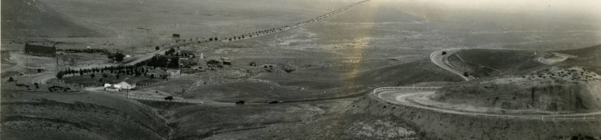
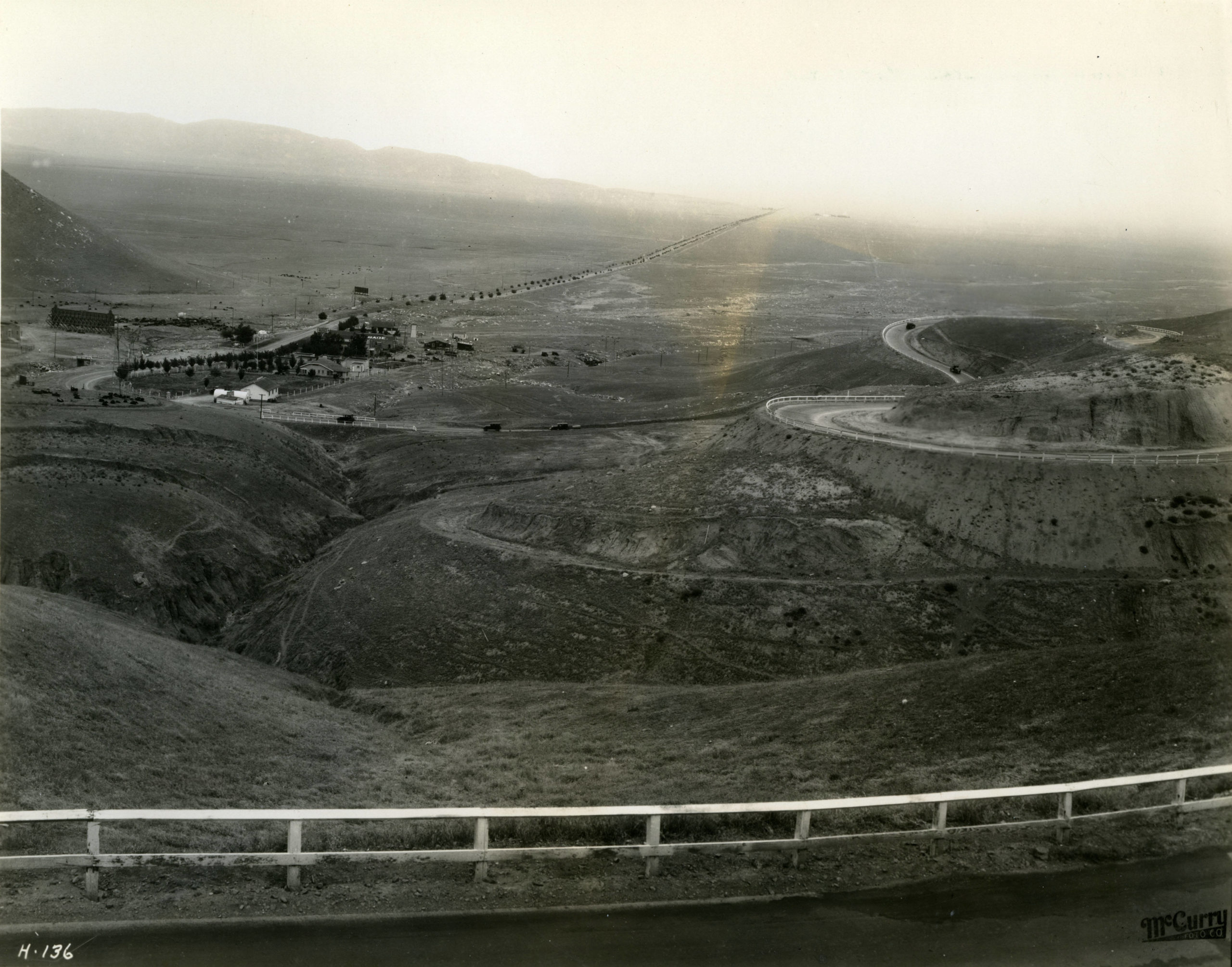
Featured Photo
The Ridge Route is well known for its views. Wide expanses of open land, mountains, and canyons as far as the eye can see. One of my favorite viewpoints is just south of the National Forest Inn looking northerly. From there, you can see all the way to Liebre Summit with Kelly’s Halfway Inn and Reservoir Summit plainly visible. To the west, the distant peak of Frazier Mountain (8000′) is visible.
