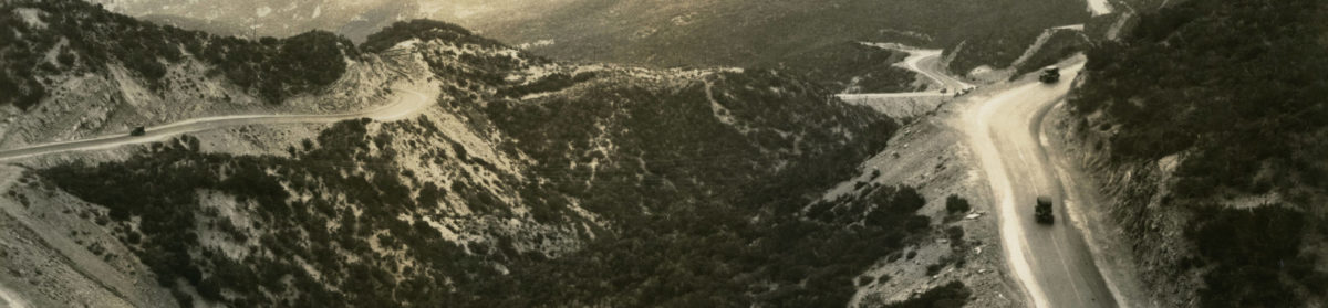
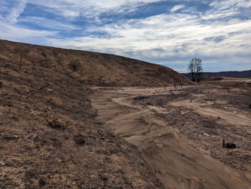
Last weekend, we took a trip over the Ridge Route to assess damage caused by Tropical Storm Hilary. According to the LA County Department of Public Works, Sandberg and Castaic received a little over 4 inches of rain during the storm. Most of this fell in a day, which is a lot for that area. We were concerned additional damage may have occurred to the road. We were pleasantly surprised by what we found.
The storm itself caused little damage to the roadway with few exceptions. Most of the damage was localized to three locations, the Spring 2023 landslide at the south end, Swede’s Cut, and near the Liebre Maintenance Camp site. With the exception of one site, all the work that had been done at our CUTRR events was successful. The drains we cleared remained clear and worked well. We wish to thank all that have helped us with our events. We couldn’t do it without you all. We need to continue this work as well as other restoration work as time permits. Dates for upcoming events will be announced soon.
Landslide from Spring 2023. This has moved a bit more since May 2023.
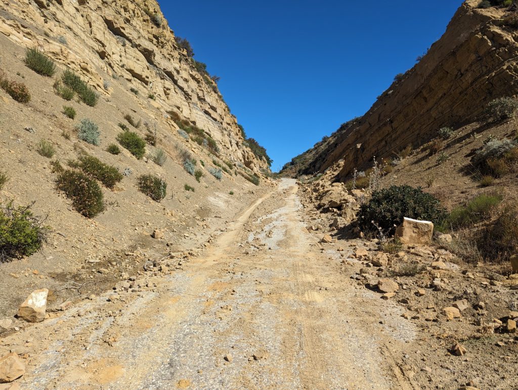
Swede’s Cut in August 2023. This was cleared earlier this year but the recent storm caused more debris to collect. Still passable but narrow.
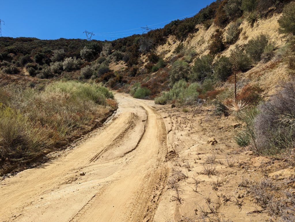
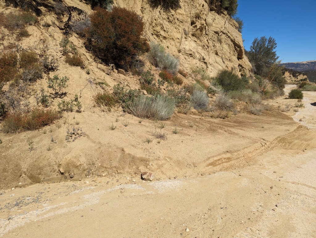
North of Reservoir Summit, the roadway degrades in quality a few times. The most notable is about 0.5 miles north of Reservoir Summit where a large amount of debris has washed down from the slope above. The drains are mostly intact with some partly blocked. Two larger mudslides partly block the roadway as well, adding to the debris problem by blocking drainage. We are working on a solution for this, which will likely be using a blade to clear the road.
Just north of Reservoir Summit, looking south.
One of the larger debris cones partially blocking the roadway. These are from earlier this year and were augmented by the tropical storm.
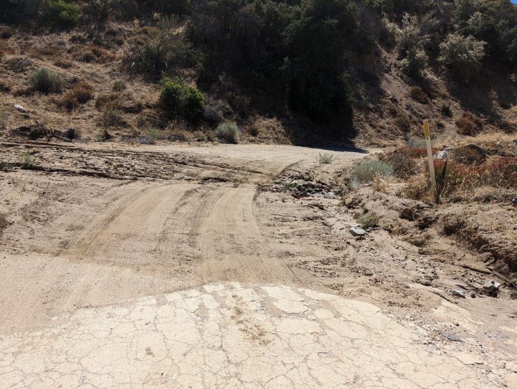
The northern end of the roadway from the Tumble Inn to Sandbergs is still open to traffic after the storm. However, it is not recommended for standard autos or lower clearance vehicles at this time due to the increased amount of debris on the roadway. One location in particular, shown in the photo below, makes it nearly impassible for such vehicles.
Debris crossing the roadway near Liebre Maintenance Camp. This was the site of one of our CUTRR events in October 2021. Our work did help for a while but an ever-increasing amount of sediment has once again blocked the roadway. The drain, which we cleared at that time, has remained in good shape.
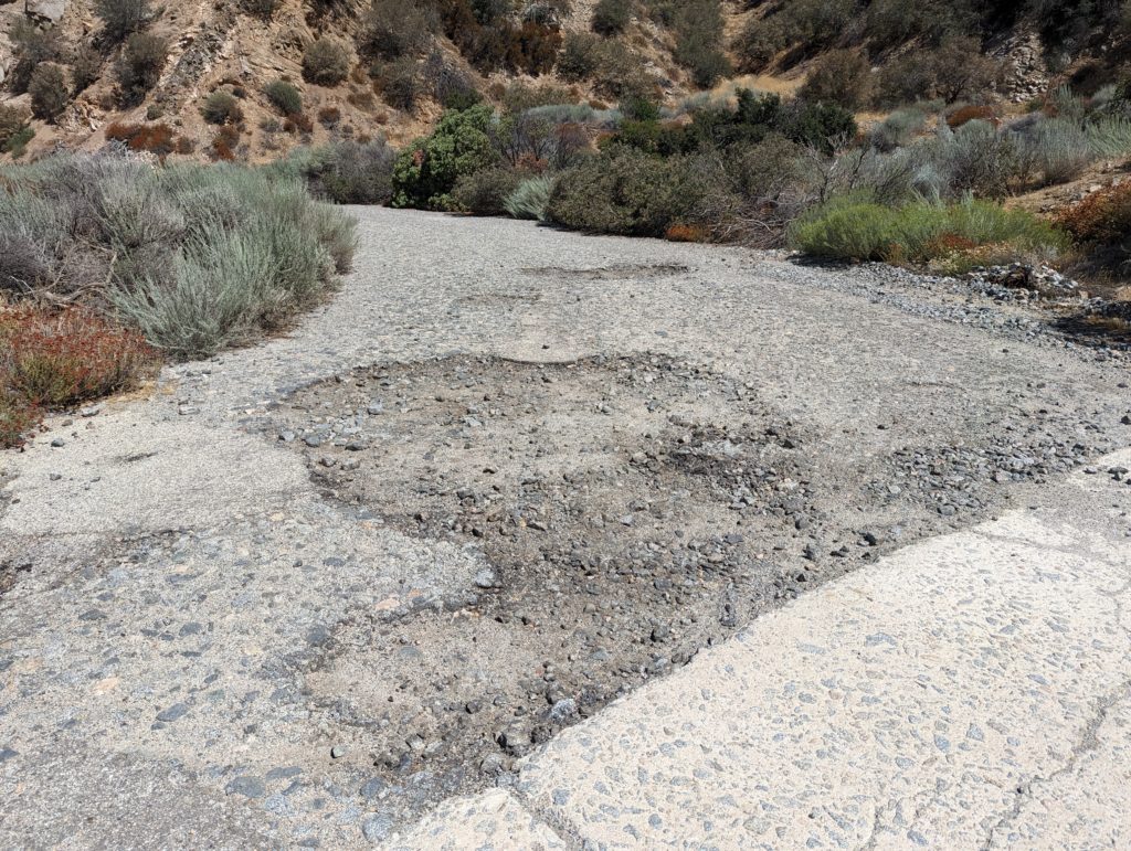
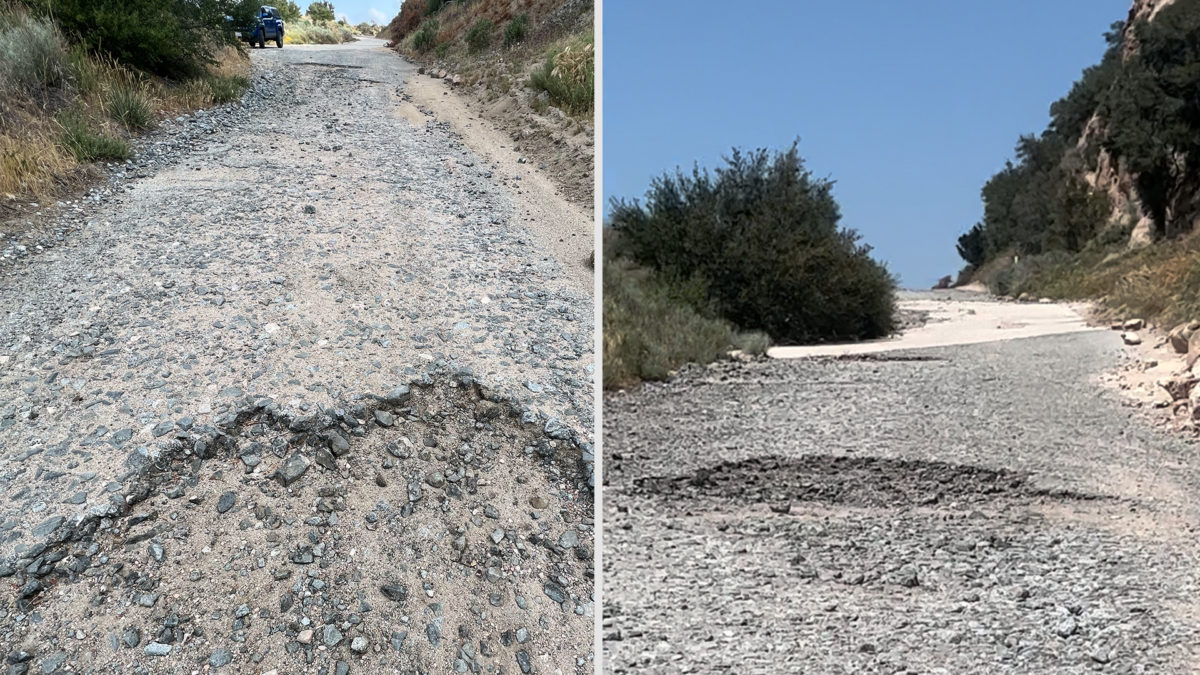
Heading north toward Sandbergs, a few locations where the pavement was breaking up were noted. We are working with the USFS to get these repaired, even on a temporary basis, in the very near future.
At Horseshoe Bend, a large pothole is forming which we intend to repair as soon as possible.
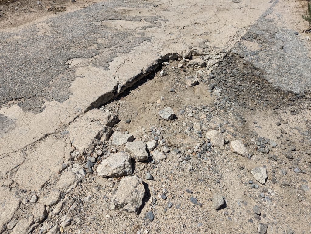
Concrete and asphalt breaking up near Liebre Summit. This is one of the worst sites we plan to repair. The winter storms and the tropical storm have made this section a lot worse.
The Ridge Route Preservation Organization is looking to repair potholes in the particularly rough sections by Granite Gate and Horseshoe Bend. With intent to preserve the road and make it more accessible to the public as well as emergency services.
In search of a person or company that has experience filling potholes, willing to advise and help with process and materials. Looking for volunteers interested in restoring the Old Ridge Route.
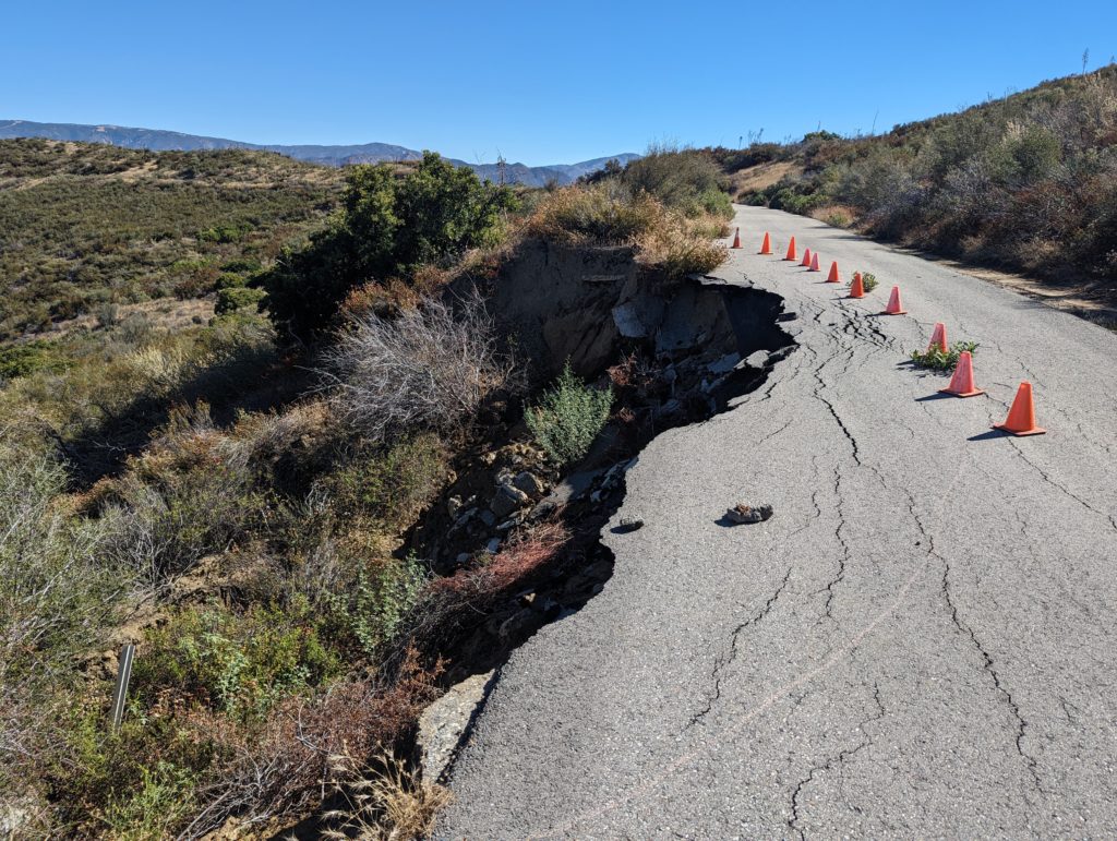
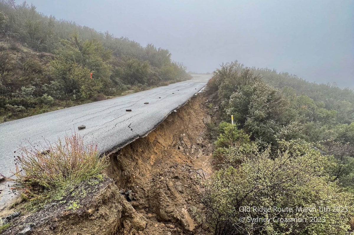
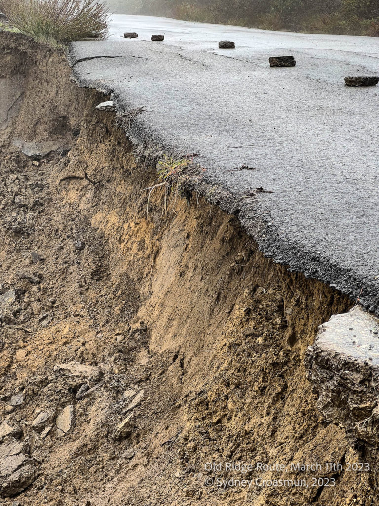
The Old Ridge Route has suffered a landslide just north of the gate in Castaic. At 0.82 miles north of the gate, about a 25ft length of the roadbed has been compromised. This is on the west side of the road and about 5-6ft deep into the road surface.
The 2018 pavement still remains intact, though there is no foundation under it. It is not advised to drive the road, even if a gate is found open. It can be potentially dangerous as these landslides aren’t always obvious from the road surface. The weight of a car could cause collapse of the road surface, especially when the hillsides are saturated.
If you are traveling on foot or by bike, please be aware of the road under you. If an area looks to be sinking, avoid it. Keep clear of cliffs and steep edges.
If you are interested in road repair and clean up efforts, please subscribe to our mailing list. We will be sending out volunteer opportunities as the area dries up.
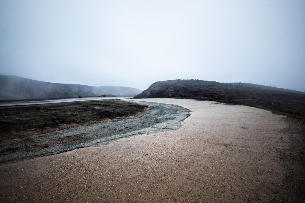
Near Ridge Road Garage. Courtesy – Sydney Croasmun
From one of our members – Sydney Croasmun:
There was a real problem with roadways washing out leading up to the construction of the 1915 Old Ridge Route. That ended up being the deciding factor for the placement of the road. When surveying locally, there were pre existing options that could have been used in place of the section we now know as the Ridge Route.
So why would they choose to essentially start from scratch instead of using a well known road as one of the first California highways?
One by one, the pre existing options were disqualified by Division VII Highway Engineer, W. Lewis Clark. San Francisquito Canyon was deemed “a steep, narrow, dangerous way that crosses a creek too often”. Soledad Canyon had a history of constant washouts. Bouquet Canyon, known at the time as “Deadman’s Canyon Road”, was disqualified on account of “sharp turns, steep pitches and threatening drainage problems; no way of joy”. Finally Mint Canyon was deemed excessive in length among other problems.
The Ridge Route was part of the Inland Route – one of two “Trunk Roads” running north and south through California. A sister road to Highway 1. It was of great importance that this road stay open and functional – rain or shine. With the existing roads disqualified, W. Lewis Clark set out with a few pack mules to find a new, suitable route.
The Ridge Route was a type of road new to America. Inspired by European engineers, they set out to build this new route on the tops of the mountains – when it was common practice to build in canyons. This avoided river and creek crossings and eliminated the need for bridges. Preventing many of the nasty washouts that happened regularly on canyon roads.
That’s why the Ridge Route was built along the ridges!
Road Conditions Update
The storms of December 2022 and January 2023 have hit the roadway hard. Damage is fairly widespread with mudslides and rockslides being the order of the day. Reports given to us by members and the public have shown sections to be impassible by a standard automobile in many locations. From the Tumble Inn to Sandberg, there are numerous areas with flooding, mud, and rockslides. A few larger slides have been noted near Swede’s Cut and Serpentine Drive as well. At this time, it is not known if further damage has occurred between the Tumble Inn site and Swede’s Cut. It does not appear that the roadway has suffered similar damage to that of 2005, which saw the loss of three major sections of roadway. Weather permitting, we will be conducting a survey of the roadway over the weekend of February 4. As this winter is not yet over, further damage may still occur, likely in the form of landslides. We are hoping none are catastrophic, but years of minimal maintenance are taking their toll. CUTRR events will be scheduled later this year after this winter and spring calm down. Right now, we have a few targets for work regarding clearing drainages to prevent or mitigate flooding and sedimentation on the roadway. Stay tuned to our CUTRR pages for updates on those events.
It is also imperative that no travel other than emergency or essential work be taken over the Ridge Route during this period. Permanent damage to the roadway can be done if care is not taken. Do not travel beyond the gates if they are open. Those gates are locked by default and you can get stuck!
Ridge Route Mapping Update
Our mapping project is in its final phase! The base map and basic features are nearly done. Photos and additional information are being added at this time. Once it is available, we will make an announcement on the site where it can be viewed.
RRPO YouTube Channel
Did you know we have a YouTube channel with videos on the history of the Ridge Route and various aspects of the current status of the roadway? We’ve posted a few videos recently showcasing some of the unique history of the roadway. Check it out and subscribe!
Would you like to write an article for our newsletter? We are looking for stories about the road, experiences you’ve had, or information about the history. Perhaps something about the things you can see alongside the roadway, such as the plants and geology. Let us know! We’d love to hear about it!
The Route Fire burned a section of the Ridge Route (hence the name) from Callahan’s to just south of Templin Highway. Thankfully, the fire didn’t destroy the last remaining Ridge Route structure, Martin’s Garage. It did expose quite a few sections of the roadway that were bypassed and buried long ago. This section, just above Martin’s, is nearly completely buried by debris. Only patches of paving and a lone c-monument remain visible today. Scenes like this could be commonplace should a fire strike the rest of the roadway, something we very much want to avoid.
The Ridge Route Preservation Organization has accomplished quite a bit so far. We can’t do it without your support. We have a lot more to do!
Here is a short list of some of those.
Created the 501(c)3 Non-Profit Public Benefit Ridge Route Preservation Organization in January 2001.
Placed the Historic Ridge Route onto the National Register with the help of Angeles National Forest Archaeologist Michael J. McIntyre September 25, 1997
Established a Memorandum of Understanding (Now a Volunteer Service Agreement) with the Angeles National Forest which allowed our organization to clear minor landslides and fill potholes.
Reservoir Summit was the mutual agreed location where we deposited dirt cleared from the road that it created a small mountain known as “Scotty’s Mountain”.
Identified all drains on the road and marked and numbered each one with a state approved marker.
Stepped in to complete posting Picture Placards on concrete monuments provided by a non-profit organization that went out of business. Photo posted at each historic site from the Harrison I. Scott archives.
Contacted the Federal Highway Administration in Colorado (the nearest office) and offered to fly them out at our expense to examine the major landslides on the Ridge Route from the January 2005 “one -hundred – year rainstorm”. The Federal Highway Administration repaired the road working with Angeles National Forest.
Replaced the steps at the Tumble Inn historic site that were being damaged by off road motorcyclists in cooperation with late Ranger Bob Blount.
Former President, Harrison I. Scott brought further attention to the historic Ridge Route by doing two over the road television programs. First, a one – hour program going over the road with Huell Howser in a 1915 Model T. A one – half hour program going over the road in Jay Leno’s 1915 Franklin.
There is a lot more we need to do. We are still working, albeit slowly, on getting the roadway reopened. We need your help with our Ridge Route Management Plan, which we will submit to the Angeles National Forest as a part of the opening plan. We will be holding Zoom meetings again soon regarding this plan and more. Make sure to subscribe to our website to learn more.
RRPO Board Update – Treasurer Needed
Our current Treasurer, Richard Valot, will be resigning by the end of the 2022. We wish to thank him for his many years of service and wish him well! We are looking for a new person to fill the position and help us move forward. If you are interested in learning more about the position or are interested in applying, please contact us!
Ridge Route Mapping Update
Our mapping project is nearly complete! Our base map is done and now we are working on adding other features. Once it is available, we will make an announcement on the site where it can be viewed.
RRPO YouTube Channel
Did you know we have a YouTube channel with videos on the history of the Ridge Route and various aspects of the current status of the roadway? We’ve posted a few videos recently showcasing some of the unique history of the roadway. Check it out and subscribe!
Would you like to write an article for our newsletter? We are looking for stories about the road, experiences you’ve had, or information about the history. Perhaps something about the things you can see alongside the roadway, such as the plants and geology. Let us know! We’d love to hear about it!
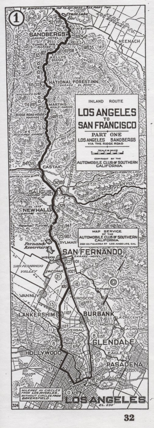
Featured Photo
From our archives – a 1921 Automobile Club of Southern California strip map showing the Ridge Route from Los Angeles to State 138. Some things to note are modern Quail Lake being named Crane Lake, Castaic being shown further south (train station was located at current Castaic Junction), the Newhall Tunnel still in place, and the option of going via Cahuenga Pass instead of along current San Fernando Road.