May – June 2022 Newsletter

Superelevated curves heading down the north Reservoir Summit grade

Roadway Update

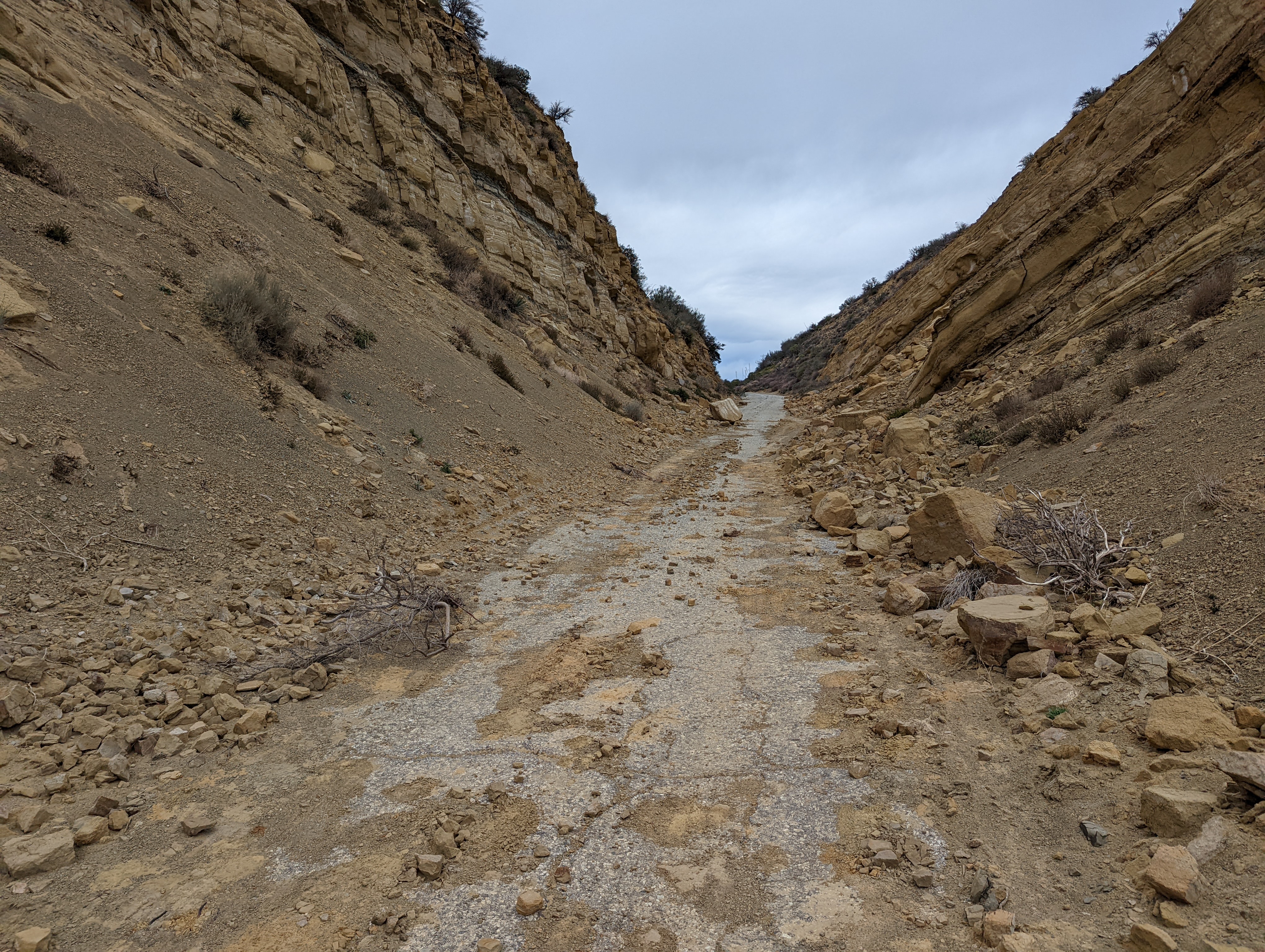
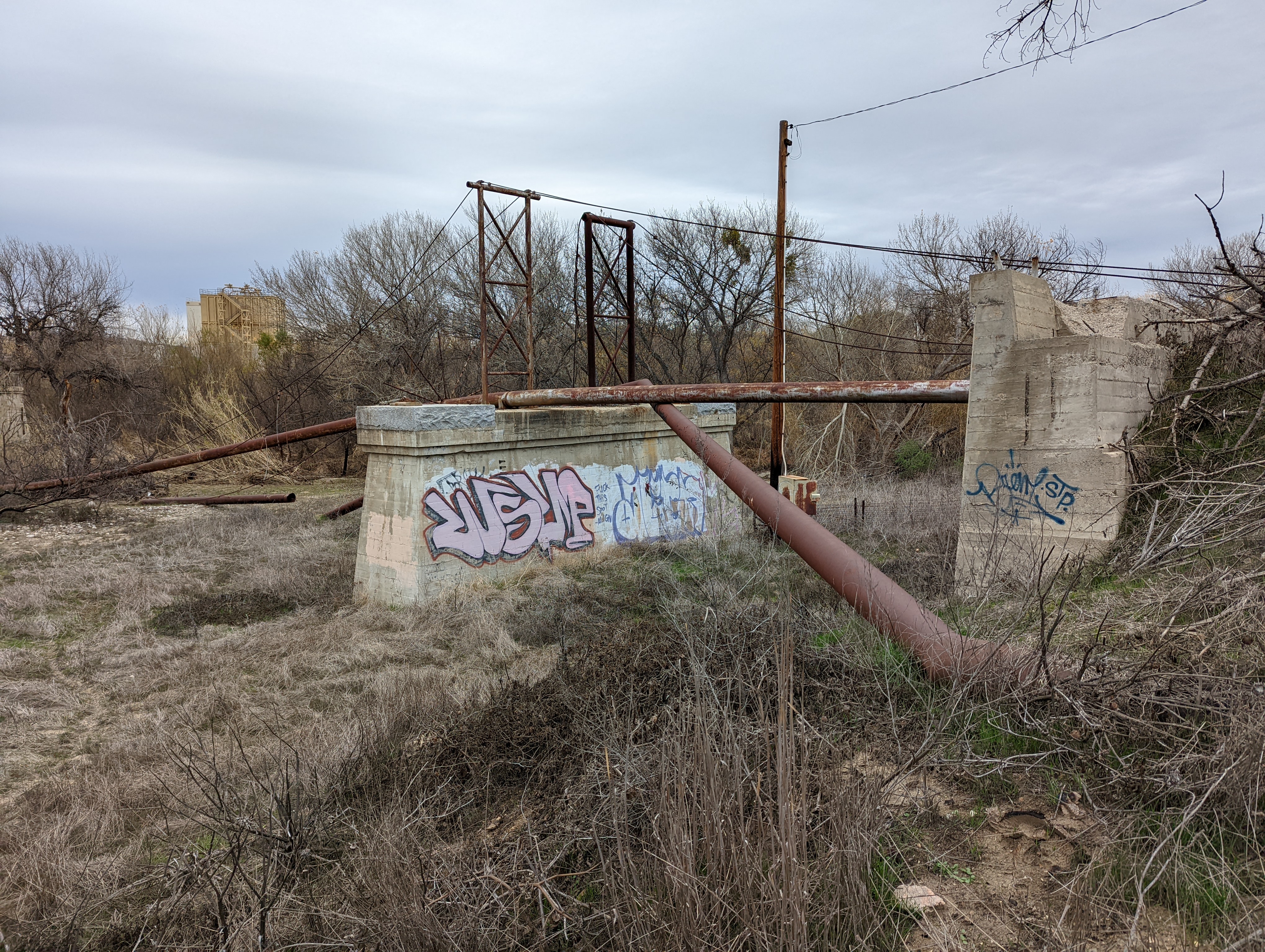
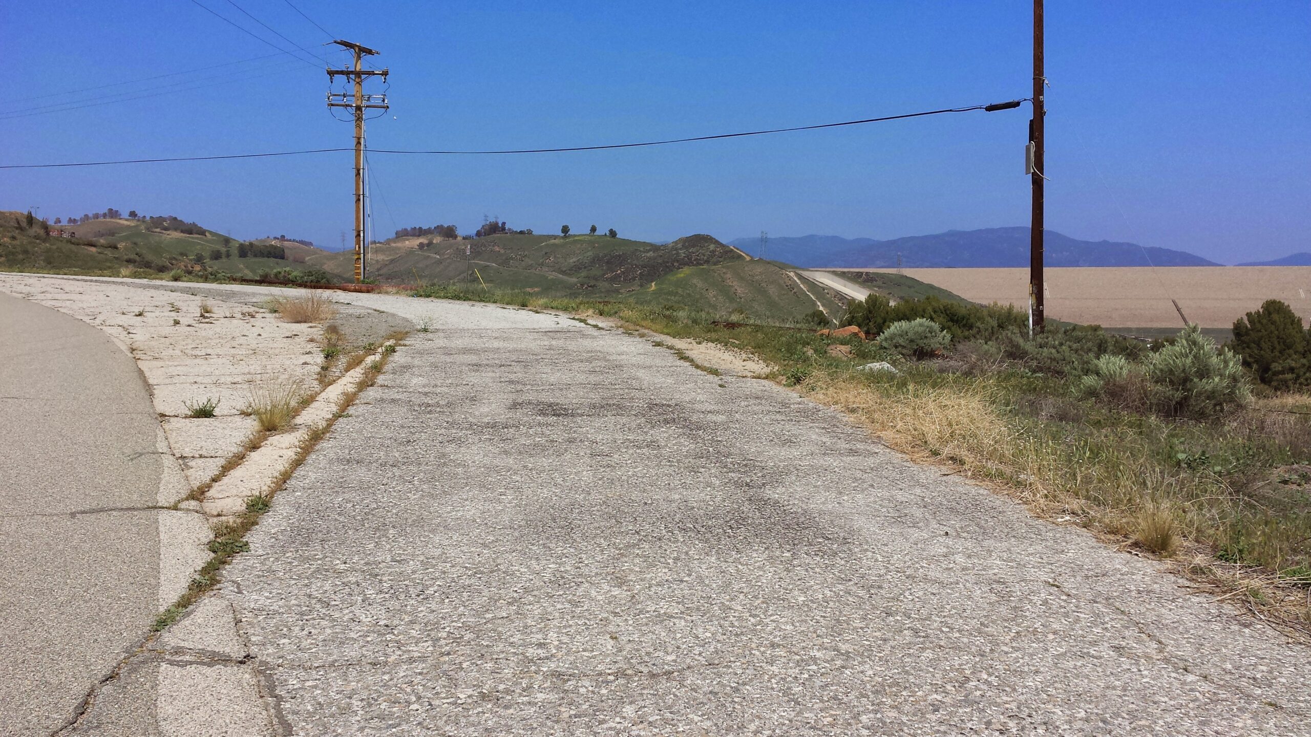
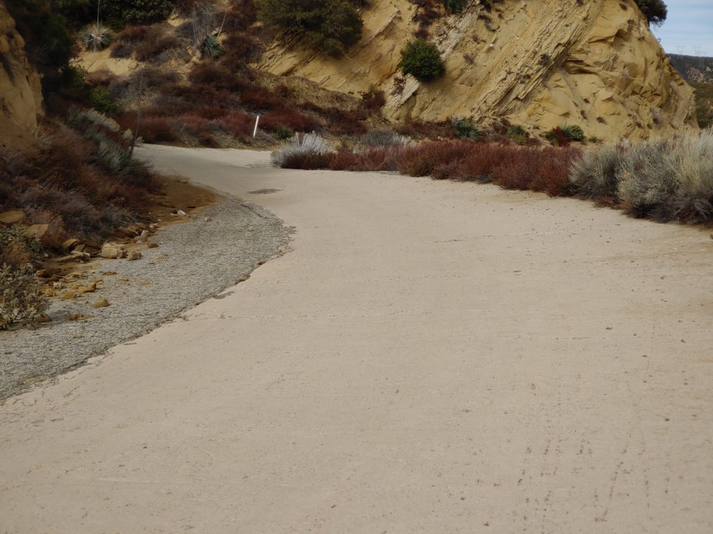
We have some good news regarding the condition of the roadway. Southern California Edison and other contractors recently completed a project to replace some of the wires on their power lines. To make sure the vehicles they used could traverse the roadway and not do any damage, they cleared the roadway. The large rockslides in Swede’s Cut and Serpentine Drive reported in January have been removed. The large boulder that was moved during our August 2021 CUTRR was broken down yet more and moved further from the roadway. The gates still remain closed and the roadway between the gates is only open to non-motorized travel.

CUTRR Events and Online Meetings

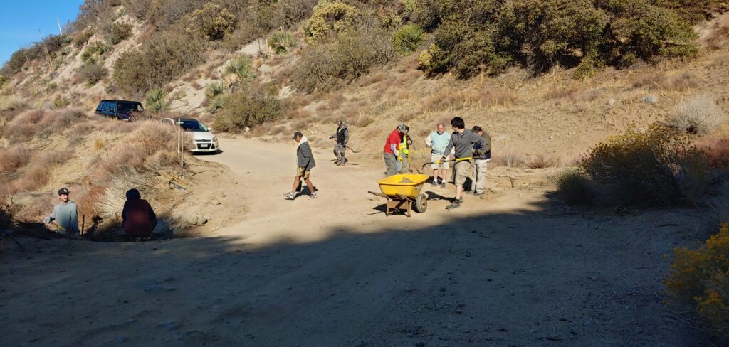
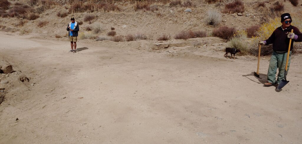
Our CUTRR events are currently on hold due to personal obligations. They will resume as soon as possible. We are also working with the USFS to get permission to use heavier equipment / mechanized tools to increase our efficiency. Thank you all for your patience and continued support.

Our online meetings should resume soon. I am working on a date for May at this time. Previous meetings have been quite successful, and I would like to keep that going. Your input has been very helpful. Future meetings will be recorded, as requested through our recent poll. If you miss a meeting, it will be posted on our YouTube channel.

Website Subscription

Make sure to subscribe to our site to get updates on upcoming CUTRR events and Ridge Route news.

Reporting Problems on the Ridge Route

Events such as January 26, 2021 when big rigs tried to travel the Ridge Route and past fires, we thought it was a good idea to have a place to report things. If you see something wrong on the Ridge Route, be it a developing washout, large vehicles traversing the roadway, or things out-of-the-ordinary, we have set up a web page to help you report things on the road. We will pass the information along to the appropriate agencies as needed.

To Report Problems or other issues on the Ridge Route, please use the website below. The web page is also located under our “Current Roadway Conditions” page in the menu.

Upcoming Articles

Would you like to write an article for our newsletter? We are looking for stories about the road, experiences you’ve had, or information about the history. Perhaps something about the things you can see alongside the roadway, such as the plants and geology. Let us know!

Featured Photo

Swede’s Cut, shortly after opening of the Ridge Route in 1915

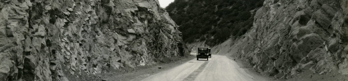
Swede’s Cut, is the largest and most famous cut along the Ridge Route. It slices through a ridge at 110 feet in depth. The cut is also the source of many rockslides, due to the steep sides and easily broken sedimentary layers within. We do hope to see it as clear as it was in 1915 someday. With your help, we will make that happen.

March – April 2022 Newsletter

Ridge Route Update

Swede’s Cut in January 2022. Courtesy – Michael F Ballard

In mid-January, I took a trip over the Ridge Route to survey the damage from the recent storms. The results were very mixed. Like in December, there were many small rockslides over most of the road from Serpentine Drive to Sandberg. None of the rocks were all that large but did create problems for traversing the roadway. The CUTRR work that was done in October was also compromised, with additional material deposited on the roadway making travel nearly impossible for standard automobiles. The good news was there was no section that was heavily damaged by the storms. We seem to have gotten lucky with that, so far. This winter has certainly been a wild one, ranging from extended dry periods to heavy rain and snow.

We are working with the USFS to get these slides cleared and to get permission to use heavier equipment to do some of the work ourselves. We are also working with the County of Los Angeles to help ensure that road closures on I-5 due to storms or fires don’t impact the Ridge Route, as they have in the past. Dates will be announced soon for the next CUTRR event, though due to personal obligations, I may be unavailable to lead the events in April or May.

The gates still remain closed and will for some time. We are working to get them opened on a seasonal basis once we reach an agreement with the USFS regarding some issues with the roadway. They, of course, have the control over the road and the decision is still up to them. We just want to make sure the roadway is available to the public and kept in good order. Without that, we lose a piece of history, something we cannot allow.

Monthly Meetings via Zoom

We have been hosting monthly meetings, open to the public, to talk about the Ridge Route, what is happening, future CUTRR events, and its history. There is a lot going on and things are looking positive for the Ridge Route, more than they have in the past. These meetings will be online via Zoom. We want to get more people engaged in our continuing efforts to reopen the roadway and help keep it preserved. The schedule is still being worked out, so make sure you’re subscribed to our website to stay informed. A meeting in March will be announced soon.

Public Forums

We invite all to join our discussion forums, which are now available using the link below. The appearance and registration are still being adjusted, so bear with us. Check it out and let us know what you think! Share your Ridge Route stories and chat with other Ridge Route enthusiasts!

https://ridgeroute.org/forums/

Membership

We are working on sending notices for our members to renew their memberships. We need your support to keep this momentum going and to reopen the roadway. Memberships such as yours help us with this effort. You can join for the first time, renew, or just submit a donation online using our secure website using the link below.

Website Subscription

Make sure to subscribe to our site to get updates on upcoming CUTRR events and Ridge Route news.

Reporting Problems on the Ridge Route

With all the recent fire activity as well as other events such as January 26 when big rigs tried to travel the Ridge Route, we thought it was a good idea to have a place to report things. If you see something wrong on the Ridge Route, be it a developing washout, large vehicles traversing the roadway, or things out-of-the-ordinary, we have have set up a web page to help you report things on the road. We will pass the information along to the appropriate agencies as needed.

To Report Problems or other issues on the Ridge Route, please use the website below. The web page is also located under our “Current Roadway Conditions” page in the menu.

Featured Photo

Remains of the 1916 Santa Clara River Bridge

Early in the morning on March 13, 1928, the floodwaters from the collapse of the St Francis Dam reached US 99 at the Santa Clara River. The bridge, a steel through-truss span built by Los Angeles County in 1916, was quickly destroyed and sent downstream. Later, the structure was used to support a gas or oil line, which itself was later abandoned. This structure can be accessed via Feedmill Rd near Six Flags Magic Mountain.

January 2022 Open Meeting

We are trying out something new this year. As stated in our last newsletter, we are starting to hold more regular meetings, albeit online via Zoom, to help keep everyone updated on the roadway, give presentations on various aspects of the history of the road or special features, and give time to share stories about the roadway.

For our January meeting, Michael Ballard will be sharing photos from the last two trips over the roadway showing the current state of the Ridge Route and giving an update on the status of upcoming events. Come join us on Thursday, January 20 at 6 pm!

To register, please use the link below:

http://us06web.zoom.us/meeting/register/tZwtde-pqTwiH9TT3Z5xjxm-nQPIO_qrZhRl

2021 In Review

2021 has been a good year for the Ridge Route and the RRPO. We have accomplished a fair amount this year starting with two CUTRR events resulting in a clearer roadway and a better appreciation for the work we have before us. We intend to have more events in 2022 and, using the knowledge gained from the last two events, we will accomplish even more using better tools. We have also worked to survey the roadway about once a month since we gained access to the closed section. These trips not only offer the opportunity to experience the roadway and take photos, but to review what we need to do to help preserve it. Each time we go up there, we seem to find something new. Sections of original striping, wooden railing, and even some concrete curbing have been found that was thought to have been lost. Each trip is an adventure. It is something we look forward to many more being able to enjoy in the future.

The RRPO continues to have a good working relationship with the USFS, something I intend to use to help the roadway as much as possible. I know things have seemed slow and unchanging, but that isn’t the case. We are currently working with the USFS to develop a plan to reopen the roadway, keep it maintained, and restore the monuments along the roadway. It is frustrating at times but we are persistent and we will prevail. It will be reopened, it will just take time.

Reopening the roadway isn’t as easy as just leaving the gates open. The road surfacing is now over 100 years old and we want to do what we can to ensure it lasts for a long time to come. Reopening the roadway now would not be beneficial to that goal. There are steps that must be taken prior to that point. The concrete has sections where the reinforcing bar is exposed. Asphalt sections are failing. Portions of the roadway are in danger of being washed out. We need to stabilize these sections first before we would feel comfortable in having the roadway open. We are the Ridge Route Preservation Organization and without the Preservation, we’d have no Ridge Route left to protect. Our intention is still to get the roadway reopened as soon as possible, but with some restrictions to help keep the roadway safe. The main restrictions would include having the roadway open only during the dry season to reduce damage to the pavement during the winter months and ensuring overweight vehicles are not allowed on the roadway through the use of additional signage as well as working with mapping companies to reduce the problem. A study is already underway by the County of Los Angeles to potentially restrict trucks along their section of the roadway, initiated by us. Once the roadway is scheduled to reopen, we intend to work on the monuments that have long since faded away along the roadway.

All these things take time, money, and effort. We wish to thank all those that have donated their time, their money, and effort to the Ridge Route and the Ridge Route Preservation Organization. We couldn’t have accomplished what we have so far without your support. We will continue to need that support even after the roadway is open again. Special thanks goes out to Harrison Scott without whom we wouldn’t even be this far. We would also like to thank Ray Kidd with the Angeles National Forest for helping us and guiding us as USFS volunteers.

If you’d like to help with the reopening plan or any other part of the Ridge Route efforts, let us know!

November – December 2021 Newsletter

Ridge Route Update

With winter coming, we will be shutting down our CUTRR projects until March or April 2022, depending on how winter goes. Planning gets to be a bit more difficult when dodging rain and snow storms. Those same storms also bring additional hazards to the historic roadway. To ensure both yourself and the roadway stay as safe as possible, please do not travel the roadway during or just after a heavy rain or snow storm. Mud, rocks, and other debris may be present on the roadway blocking the roadway. The concrete paving is also most vulnerable during this period and can be easier to break with a wet base. We can all do our part to help keep the roadway safe.

Overall, the roadway is in decent shape with some major exceptions. Those exceptions are a part of our CUTRR goals and what we intend to get the USFS to repair as needed. The gates at both ends remain closed and as always, if you see them open DO NOT expect them to remain open for the duration of your visit. USFS, utility companies, and other groups with access may close the gates behind them.

We are working with the USFS to “upgrade” our relationship with them as well as get approvals to use heavier equipment, such as skid-steers and scrapers. Using them will allow us to clear the roadway a lot easier and with greater speed while still ensuring the historic roadway remains intact. Our last two events have mostly used hand tools, which we still will use for smaller projects and to clear brush as needed. I do wish to thank ALL that have contributed to the success of these events, in any way they have contributed. Some have done so financially, others brought tools, many others have been helping swing picks and clear debris. We couldn’t, nor could we continue, to do this without all your efforts. Thank you Ridge Route volunteers!

October 23, 2021 CUTRR Event Report

CUTRR crew hard at work

We had another successful CUTRR event on the 23rd. We set the date later in October with the hopes the weather would be cooler and the fire danger would have subsided. We got that and more. It rained a bit the night before, but not enough to cancel or cause a problem. It rained / drizzled yet more when we all met in Gorman. However, when we got to the work site, the weather was near perfect.

The work was hampered a fair amount due to the lack of heavier equipment. Should we do this again without skid-steer/bobcat-type equipment, we intend to use powered tools, such as jackhammers and the like to break up and remove the debris from the roadway. We hadn’t really used such equipment in the past and I hadn’t considered it before as a result.

Despite using just hand tools, we made really good progress, thanks to our volunteers. The drain was cleared, channels were dug to help direct the water better, and a decent amount of material was removed to help prevent this from getting worse. Repairs to the drainage culvert will be necessary in the near future, however, as it is starting to rust and develop holes.

Finished for the day.

If you’d like to help plan the next CUTRR event, let us know! We can use the help.

Website Subscription

Make sure to subscribe to our site to get updates on upcoming CUTRR events and Ridge Route news.

Reporting Problems on the Ridge Route

With all the recent fire activity as well as other events such as January 26 when big rigs tried to travel the Ridge Route, we thought it was a good idea to have a place to report things. If you see something wrong on the Ridge Route, be it a developing washout, large vehicles traversing the roadway, or things out-of-the-ordinary, we have have set up a web page to help you report things on the road. We will pass the information along to the appropriate agencies as needed.

To Report Problems or other issues on the Ridge Route, please use the website below. The web page is also located under our “Current Roadway Conditions” page in the menu.

Featured Photo

Ridge Route in Castaic with Castaic Dam in the right background. Courtesy – Michael F Ballard

This month’s featured photo shows a section of the Ridge Route which seems insignificant, but contains a great deal of history. It was taken on Castaic Lake Drive just north of the Castaic Lagoon entrance. This location marks the end of the 1915-1917 Saugus to Castaic paving, the 1922 widening of the 1917 paving (the small strip of concrete at the edge of the roadway), the beginning of the “true” Ridge Route 20′ wide paving, the first curve on the Ridge Route, and the former junction with Elizabeth Lake Canyon Road (now Lake Hughes Road). Come check out this unique piece of Ridge Route history next time you visit Castaic or Castaic Lake.