Ridge Route Update
It has been a while since our last update. I’ve been busy with a move and house remodeling, which has taken me away from things. Unfortunately, we don’t have a lot to report. We are still working with the USFS to get the roadway open and develop a management plan for the roadway.
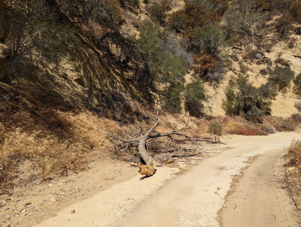
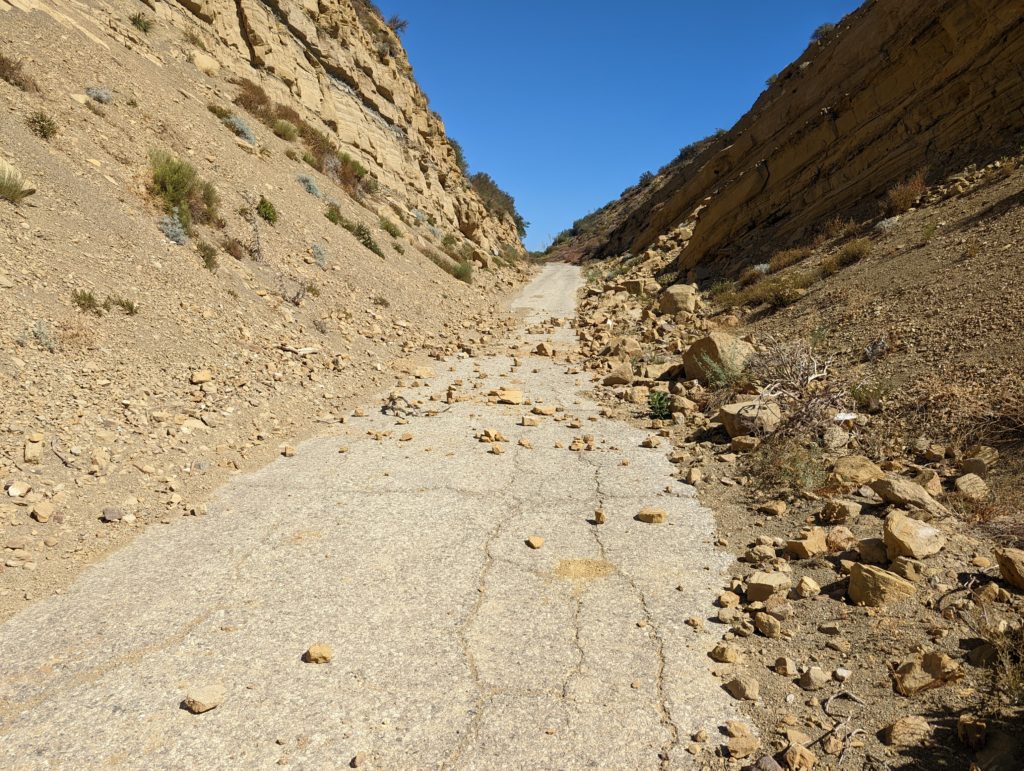
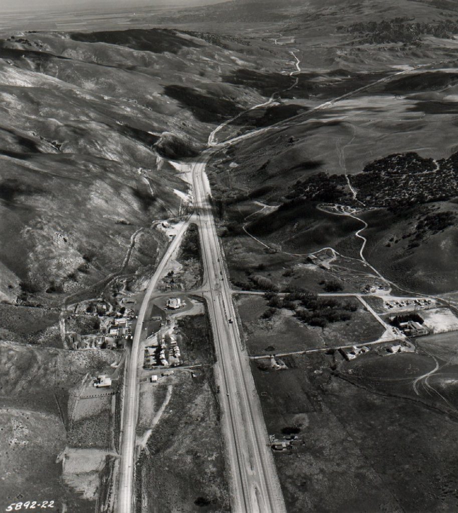
Over the weekend of August 20, I was able to take a trip over the Ridge Route to survey the roadway. For the most part, there was good news. The roadway is still in pretty good shape. Earlier this year, utility crews cleared large portions of the road from Serpentine Drive to near Sandberg. That work has helped to keep the roadway in better shape over the summer and hopefully into the coming winter. Only small rockslides were found at Swede’s Cut and below Reservoir Summit on the north side of the summit.
In early August, a small fire occurred at the north end of the Ridge Route where it meets State 138. The fire, known as the Sam Fire, was held at 150 acres and didn’t cause any damage to the Ridge Route. It did burn along State 138 from the Ridge Route to the California Aqueduct and partially up Bald Mountain. An additional fire started on August 31, known as the Route Fire, near the southern end of the Ridge Route along northbound I-5. It is not known at this time if the Ridge Route is affected though it has progressed to the Callahan Line Change site as of 1600 on August 31.
The roadway is still closed at this time even though there have been reports of the gates being left open. Keep in mind, the gates can be closed and locked behind you, so please do not travel beyond them by motor vehicle. Travel is still allowed via walking, horseback, and bicycling.
RRPO Update
Our current Treasurer, Richard Valot, will be resigning by the end of the 2022. We wish to thank him for his many years of service and wish him well! We are looking for a new person to fill the position and help us move forward. If you are interested in learning more about the position or are interested in applying, please contact us!
Ridge Route Mapping Update
We are working on a comprehensive map of the Historic Ridge Route using the Google API. We are hoping to have this available in the near future. If you are interested in learning more or would like to help contribute, let us know.
RRPO YouTube Channel
Did you know we have a YouTube channel with videos on the history of the Ridge Route and various aspects of the current status of the roadway? We’ve posted a few videos recently showcasing some of the unique history of the roadway. Check it out and subscribe!
https://www.youtube.com/channel/UCSVYTEajHIx-G4jewzHlvxg
Reporting Problems on the Ridge Route
With all the recent fire activity as well as other events such as January 26 when big rigs tried to travel the Ridge Route, we thought it was a good idea to have a place to report things. If you see something wrong on the Ridge Route, be it a developing washout, large vehicles traversing the roadway, or things out-of-the-ordinary, we have have set up a web page to help you report things on the road. We will pass the information along to the appropriate agencies as needed.
To Report Problems or other issues on the Ridge Route, please use the website below. The web page is also located under our “Current Roadway Conditions” page in the menu.
Upcoming Articles
Would you like to write an article for our newsletter? We are looking for stories about the road, experiences you’ve had, or information about the history. Perhaps something about the things you can see alongside the roadway, such as the plants and geology. Let us know! We’d love to hear about it!
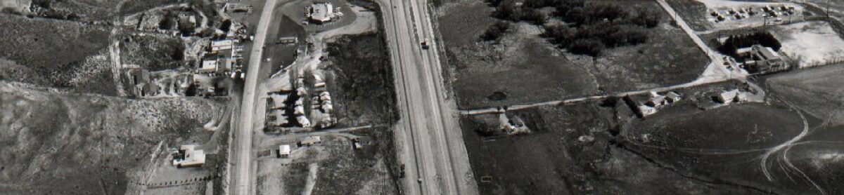
Featured Photo
This month’s photo comes to us from Caltrans and shows the town of Gorman as it was in 1958. The Ridge Route proper can be seen in the distance to the right. In the foreground near the bottom of the photo, a short section of original 1917 paving can be seen as a small diagonal roadway ending near the Gorman Motel site. This was realigned in June 1933 when the Ridge Route Alternate was under construction. While gated, the roadway remains today and can still be seen off of Gorman Post Road just south of Gorman School Road.
