The Ridge Route Preservation Organization was cleared by the Angeles National Forest to repair potholes along the north section of the Old Ridge Route from the 138 to the Tumble Inn.
The intent is to preserve the road and make it more accessible to the public as well as emergency services. Filling the potholes can reinforce crumbling sections of the road as well as prevent further damage to the original road surface.
The Ridge Route Pothole Project will begin in spring of 2024.
These improvements don’t only serve to protect the history of the Ridge Route, the repairs will also serve everyone who passes through the area. It’s a large stretch of open land that provides recreation for hikers, cyclists and hunters as well as being a heavy fire danger area. It’s important that emergency vehicles have quick and easy access when mere seconds matter.
A donation of $15 buys a 50 pound bag of asphalt cold patch.
Some good news for the road. It looks like we will be getting approval for our pothole repair project from the USFS in the very near future. As winter is approaching, we intend to do this project when weather permits, likely early next year. We are also working with the USFS on gate repair and landslide mitigation. The latter, regarding the landslide on the south end of the roadway, will take a while but we will prevail as we have in the past. More updates will be posted soon, so make sure to subscribe to our site if you haven’t already. We need your support to keep these projects going!
On another note, we will be needing a new RRPO Board Secretary. Our current secretary, Richard Schwartz, is retiring from his position and has served the RRPO well during his tenure. If you’d like to apply for this position, please contact us and we can talk. We can use your help!
Last weekend, we took a trip over the Ridge Route to assess damage caused by Tropical Storm Hilary. According to the LA County Department of Public Works, Sandberg and Castaic received a little over 4 inches of rain during the storm. Most of this fell in a day, which is a lot for that area. We were concerned additional damage may have occurred to the road. We were pleasantly surprised by what we found.
The storm itself caused little damage to the roadway with few exceptions. Most of the damage was localized to three locations, the Spring 2023 landslide at the south end, Swede’s Cut, and near the Liebre Maintenance Camp site. With the exception of one site, all the work that had been done at our CUTRR events was successful. The drains we cleared remained clear and worked well. We wish to thank all that have helped us with our events. We couldn’t do it without you all. We need to continue this work as well as other restoration work as time permits. Dates for upcoming events will be announced soon.
Landslide from Spring 2023. This has moved a bit more since May 2023.
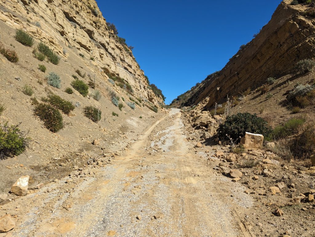
Swede’s Cut in August 2023. This was cleared earlier this year but the recent storm caused more debris to collect. Still passable but narrow.
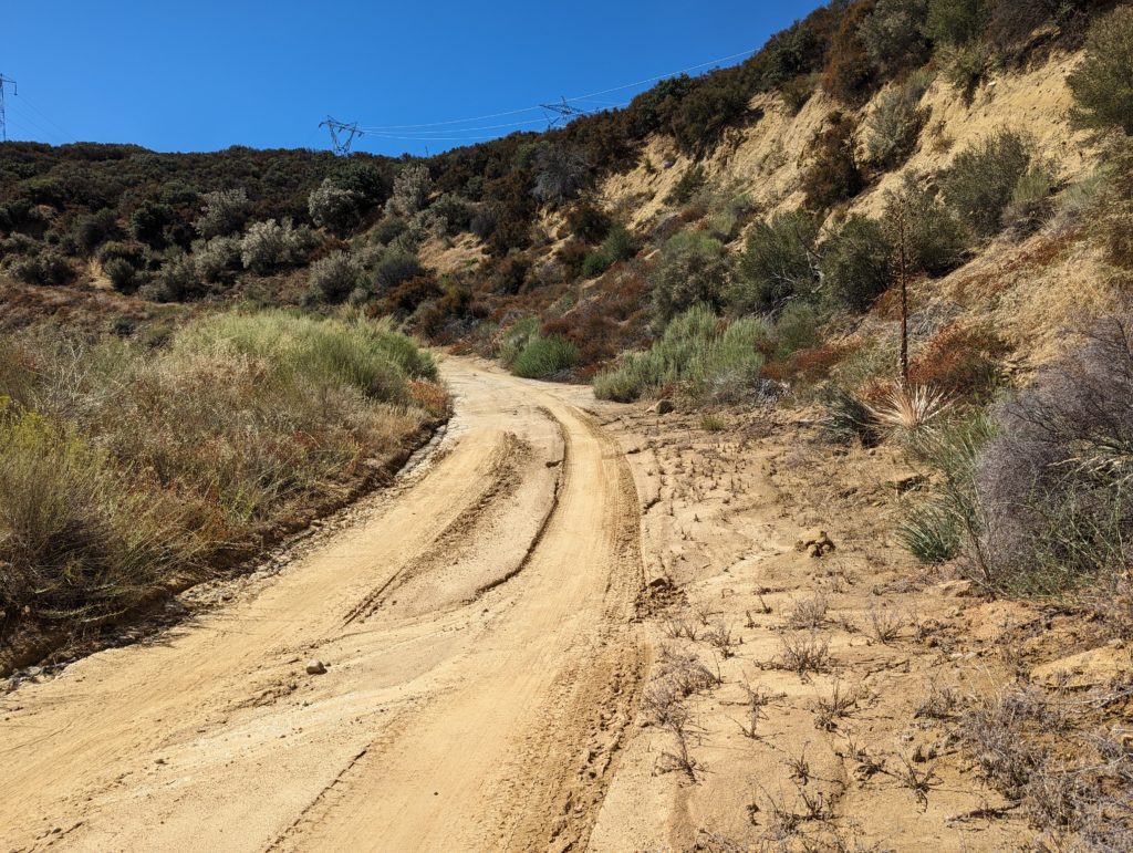
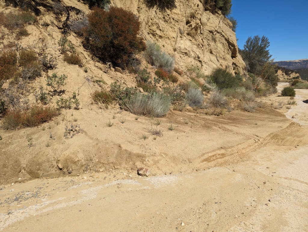
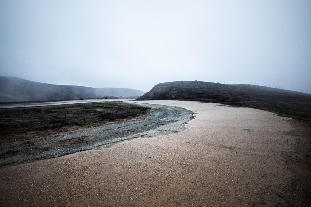
North of Reservoir Summit, the roadway degrades in quality a few times. The most notable is about 0.5 miles north of Reservoir Summit where a large amount of debris has washed down from the slope above. The drains are mostly intact with some partly blocked. Two larger mudslides partly block the roadway as well, adding to the debris problem by blocking drainage. We are working on a solution for this, which will likely be using a blade to clear the road.
Just north of Reservoir Summit, looking south.
One of the larger debris cones partially blocking the roadway. These are from earlier this year and were augmented by the tropical storm.
The northern end of the roadway from the Tumble Inn to Sandbergs is still open to traffic after the storm. However, it is not recommended for standard autos or lower clearance vehicles at this time due to the increased amount of debris on the roadway. One location in particular, shown in the photo below, makes it nearly impassible for such vehicles.
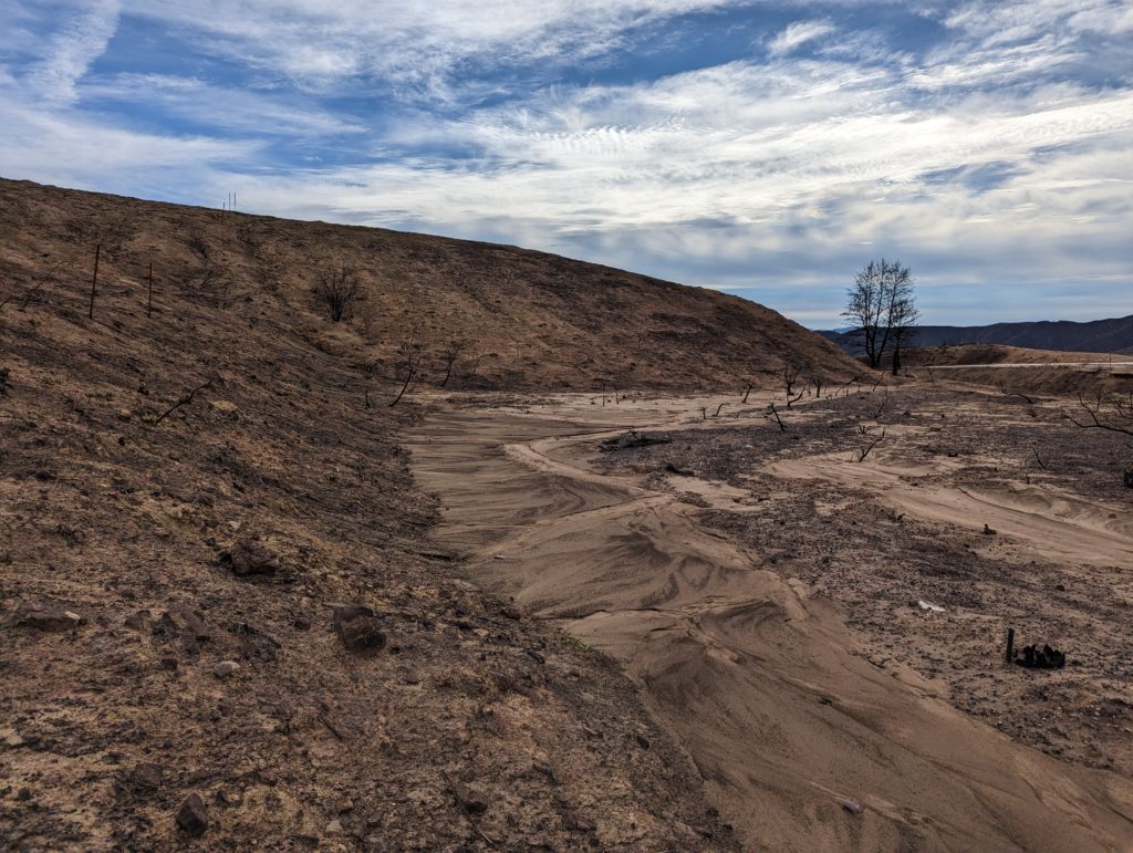
Debris crossing the roadway near Liebre Maintenance Camp. This was the site of one of our CUTRR events in October 2021. Our work did help for a while but an ever-increasing amount of sediment has once again blocked the roadway. The drain, which we cleared at that time, has remained in good shape.
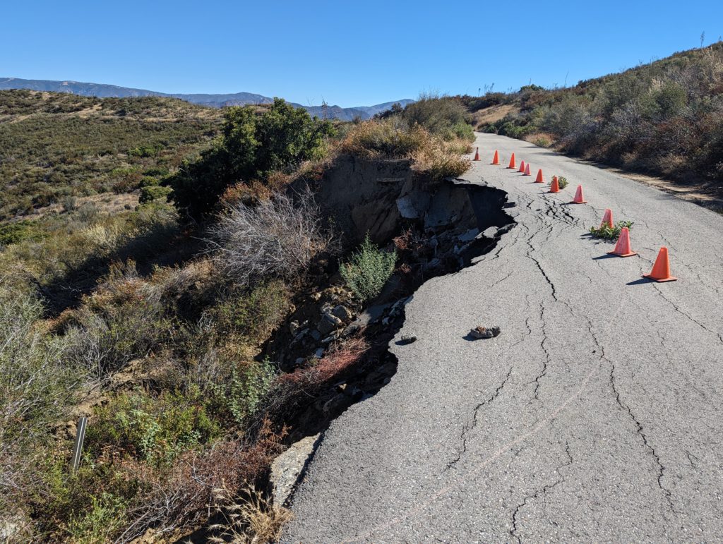
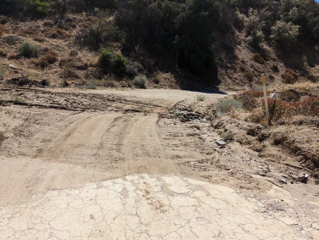
Heading north toward Sandbergs, a few locations where the pavement was breaking up were noted. We are working with the USFS to get these repaired, even on a temporary basis, in the very near future.
At Horseshoe Bend, a large pothole is forming which we intend to repair as soon as possible.
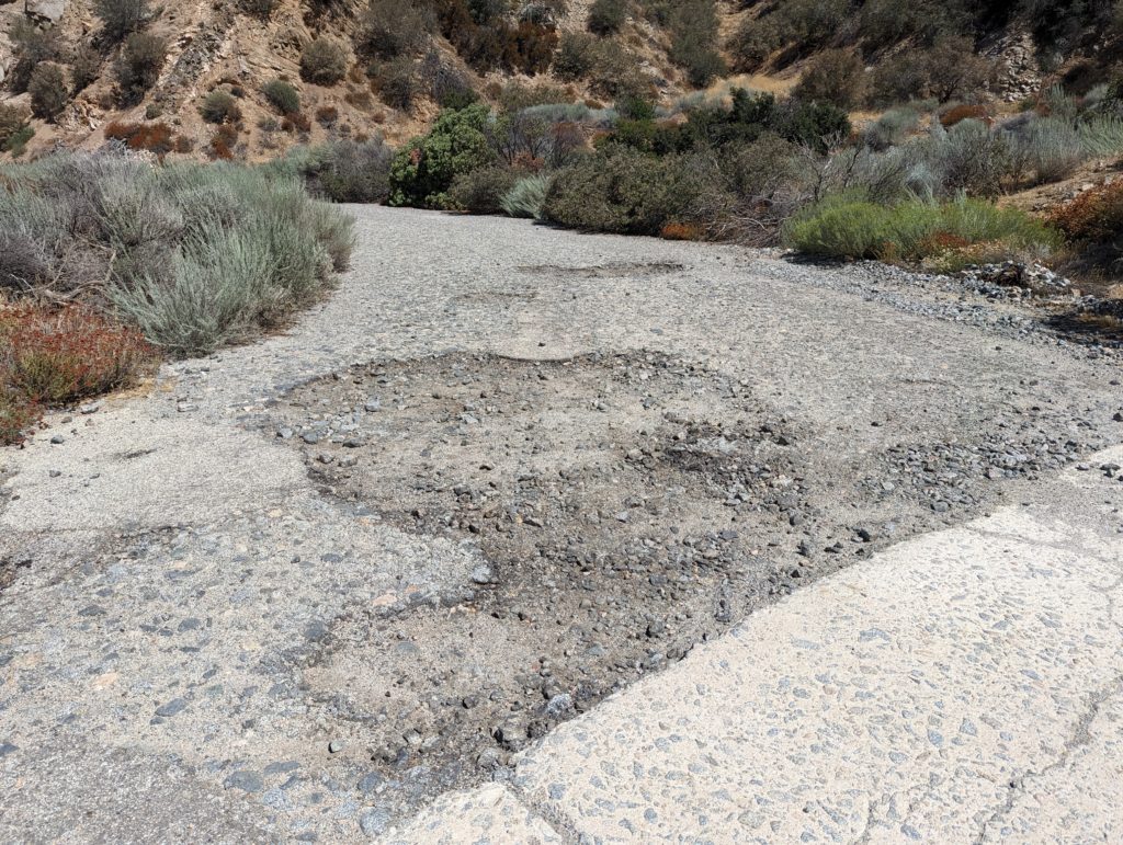
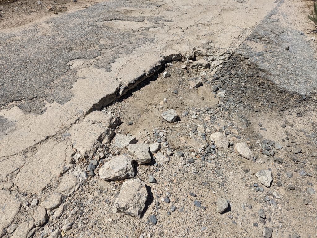
Concrete and asphalt breaking up near Liebre Summit. This is one of the worst sites we plan to repair. The winter storms and the tropical storm have made this section a lot worse.
We are planning our first CUTRR – Clean Up The Ridge Route – event to be held on May 20, 2023. The road has suffered through a lot this winter and it needs your help! Our work will concentrate on clearing drains of debris on the northern end between the Tumble Inn and Reservoir Summit. Due to conditions, we won’t be able to go over the entire roadway afterward as we have done in the past. Additionally, lower clearance vehicles are not recommended on the Ridge Route at this time.
Please RSVP so we can get a rough headcount before the event. We look forward to seeing you all out there! Please use the form below to send your e-mail for RSVP.
Please be in sturdy shoes, pants, and shirt. Hats and protective glasses are recommended depending on what work you’ll be performing.
Tools Needed:
Bring whatever tools you have to cut branches and clear debris. Supplies such as picks, shovels, rakes, pruning saws, pole pruners, mattocks, clippers, wheelbarrows, brooms, and other items may also be needed.
Meeting Location:
We will be meeting at the Gorman Carl’s Jr, 49669 Gorman Post Rd, Gorman, CA 93243, at 0800 hrs on May 20, 2023 and will be leaving by 0830 hrs.
Near Ridge Road Garage. Courtesy – Sydney Croasmun
From one of our members – Sydney Croasmun:
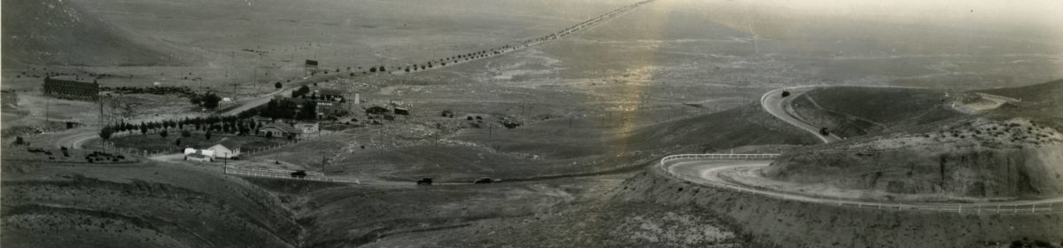
There was a real problem with roadways washing out leading up to the construction of the 1915 Old Ridge Route. That ended up being the deciding factor for the placement of the road. When surveying locally, there were pre existing options that could have been used in place of the section we now know as the Ridge Route.
So why would they choose to essentially start from scratch instead of using a well known road as one of the first California highways?
One by one, the pre existing options were disqualified by Division VII Highway Engineer, W. Lewis Clark. San Francisquito Canyon was deemed “a steep, narrow, dangerous way that crosses a creek too often”. Soledad Canyon had a history of constant washouts. Bouquet Canyon, known at the time as “Deadman’s Canyon Road”, was disqualified on account of “sharp turns, steep pitches and threatening drainage problems; no way of joy”. Finally Mint Canyon was deemed excessive in length among other problems.
The Ridge Route was part of the Inland Route – one of two “Trunk Roads” running north and south through California. A sister road to Highway 1. It was of great importance that this road stay open and functional – rain or shine. With the existing roads disqualified, W. Lewis Clark set out with a few pack mules to find a new, suitable route.
The Ridge Route was a type of road new to America. Inspired by European engineers, they set out to build this new route on the tops of the mountains – when it was common practice to build in canyons. This avoided river and creek crossings and eliminated the need for bridges. Preventing many of the nasty washouts that happened regularly on canyon roads.
That’s why the Ridge Route was built along the ridges!
Road Conditions Update
The storms of December 2022 and January 2023 have hit the roadway hard. Damage is fairly widespread with mudslides and rockslides being the order of the day. Reports given to us by members and the public have shown sections to be impassible by a standard automobile in many locations. From the Tumble Inn to Sandberg, there are numerous areas with flooding, mud, and rockslides. A few larger slides have been noted near Swede’s Cut and Serpentine Drive as well. At this time, it is not known if further damage has occurred between the Tumble Inn site and Swede’s Cut. It does not appear that the roadway has suffered similar damage to that of 2005, which saw the loss of three major sections of roadway. Weather permitting, we will be conducting a survey of the roadway over the weekend of February 4. As this winter is not yet over, further damage may still occur, likely in the form of landslides. We are hoping none are catastrophic, but years of minimal maintenance are taking their toll. CUTRR events will be scheduled later this year after this winter and spring calm down. Right now, we have a few targets for work regarding clearing drainages to prevent or mitigate flooding and sedimentation on the roadway. Stay tuned to our CUTRR pages for updates on those events.
It is also imperative that no travel other than emergency or essential work be taken over the Ridge Route during this period. Permanent damage to the roadway can be done if care is not taken. Do not travel beyond the gates if they are open. Those gates are locked by default and you can get stuck!
Ridge Route Mapping Update
Our mapping project is in its final phase! The base map and basic features are nearly done. Photos and additional information are being added at this time. Once it is available, we will make an announcement on the site where it can be viewed.
RRPO YouTube Channel
Did you know we have a YouTube channel with videos on the history of the Ridge Route and various aspects of the current status of the roadway? We’ve posted a few videos recently showcasing some of the unique history of the roadway. Check it out and subscribe!
Would you like to write an article for our newsletter? We are looking for stories about the road, experiences you’ve had, or information about the history. Perhaps something about the things you can see alongside the roadway, such as the plants and geology. Let us know! We’d love to hear about it!
The Route Fire burned a section of the Ridge Route (hence the name) from Callahan’s to just south of Templin Highway. Thankfully, the fire didn’t destroy the last remaining Ridge Route structure, Martin’s Garage. It did expose quite a few sections of the roadway that were bypassed and buried long ago. This section, just above Martin’s, is nearly completely buried by debris. Only patches of paving and a lone c-monument remain visible today. Scenes like this could be commonplace should a fire strike the rest of the roadway, something we very much want to avoid.